Here is a list of Mapillary related tools I made. All tools except OpenSwitchMaps are pre-alpha version. Maybe buggy.
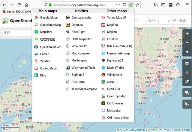
Switch map services like Google maps, OpenStreetMaps, Mapillary and so on.
Chrome/
Firefox extension.
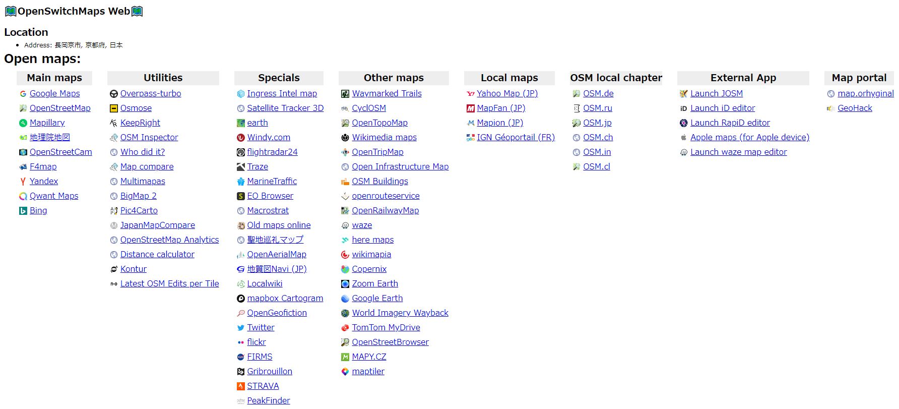
Web bookmarklet version of OpenSwitchMaps. For tablet and smart phone.

Measure the height of the object using 360 photo.
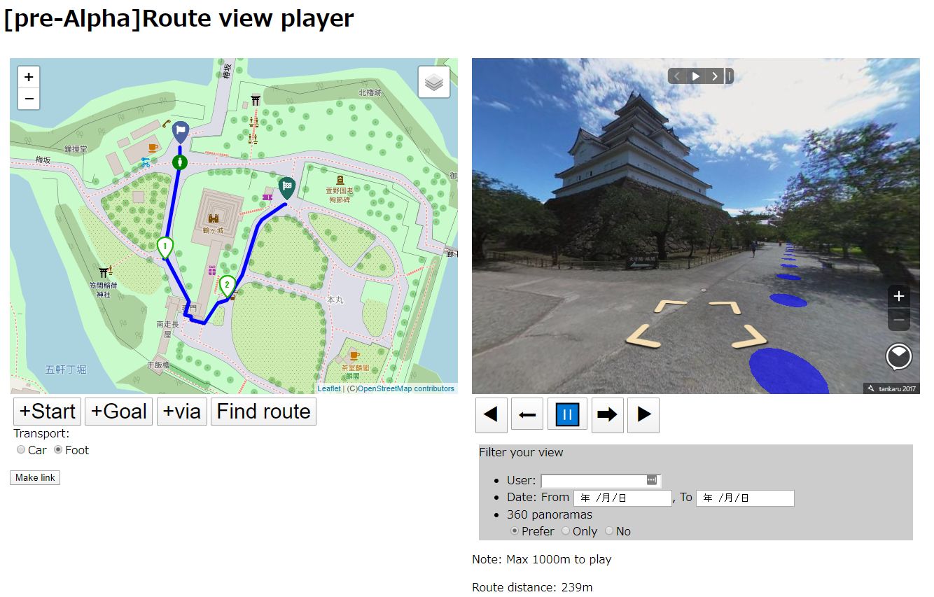
Find route and auto play mapillary photo along the route.
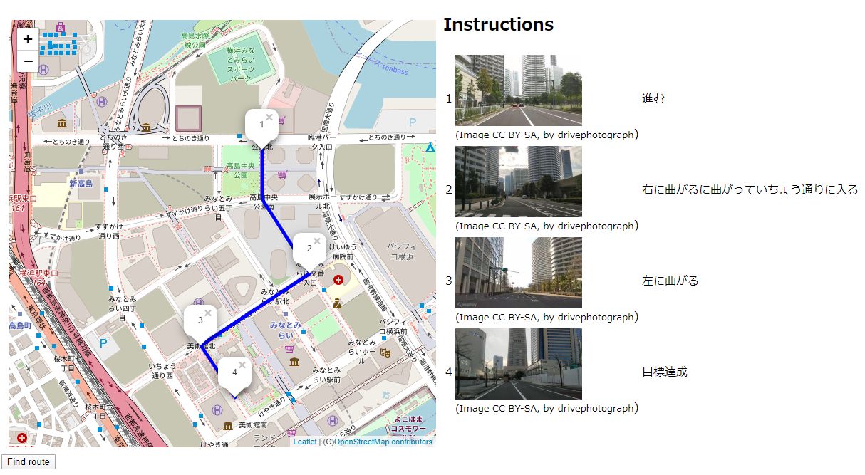
Find route and display photo at the turn.
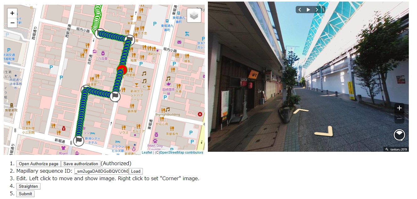
Mapillary editor to straighten sequence.
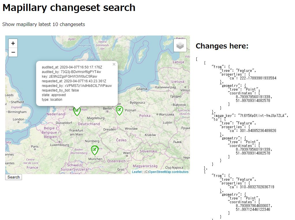
Search mapillary changesets in a local area.
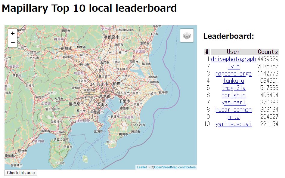
Show a leaderboard in a local area.
Mapillary photos don't have geotags. Append geotags with external tool. Windows, Exiftool required.

Capture the scenery of the past. Just retrieve a photo from Mapillary service at your location. iPhone, Safari, portait style.
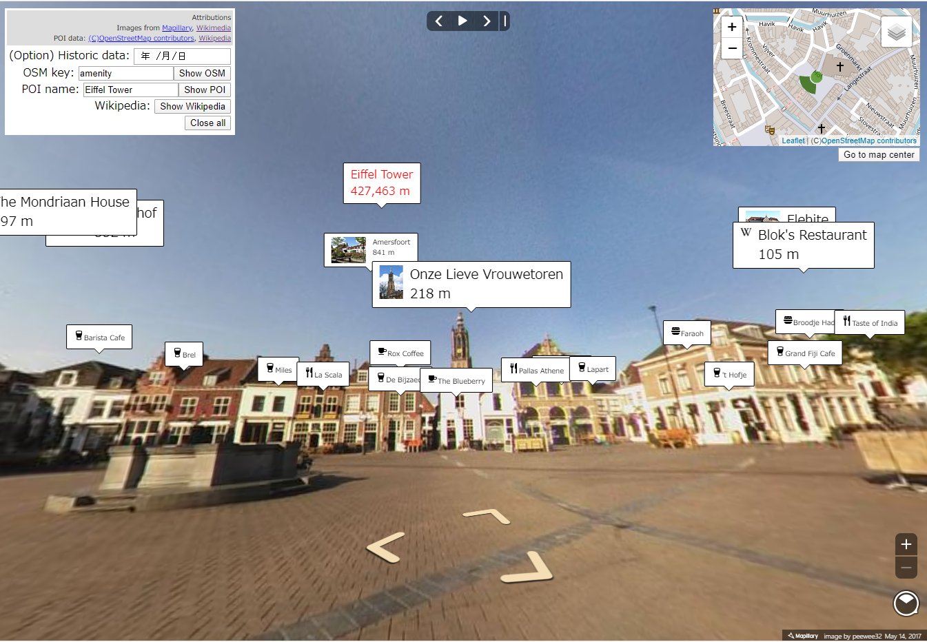
Show OpenStreetMap POIs on Mapillary 360 photo, like AR viewer.
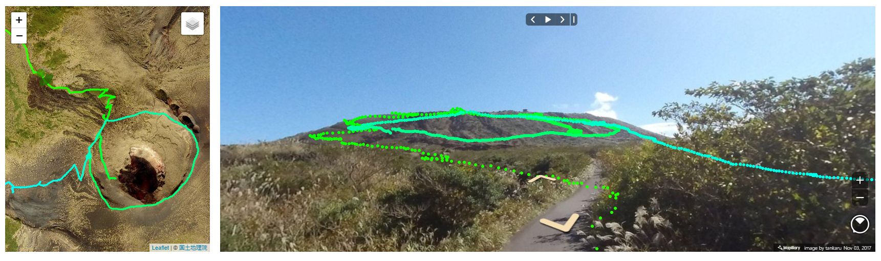
Show GPX log file on Mapillary 360 photo, like AR viewer.
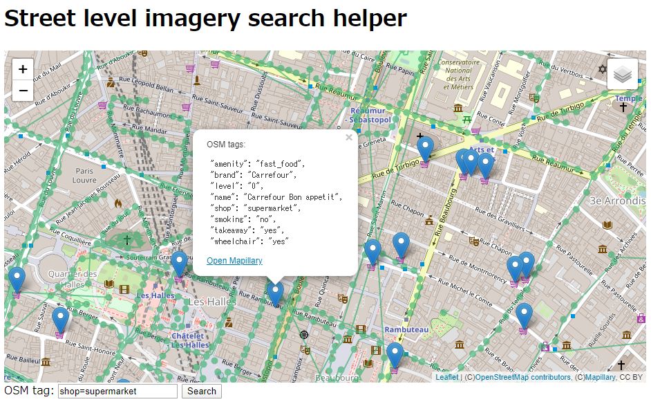
Search OSM objects via overpass, and provide Mapillary links to the found coordinates.
Report bug at Github


